Eye Navi is a single smartphone,
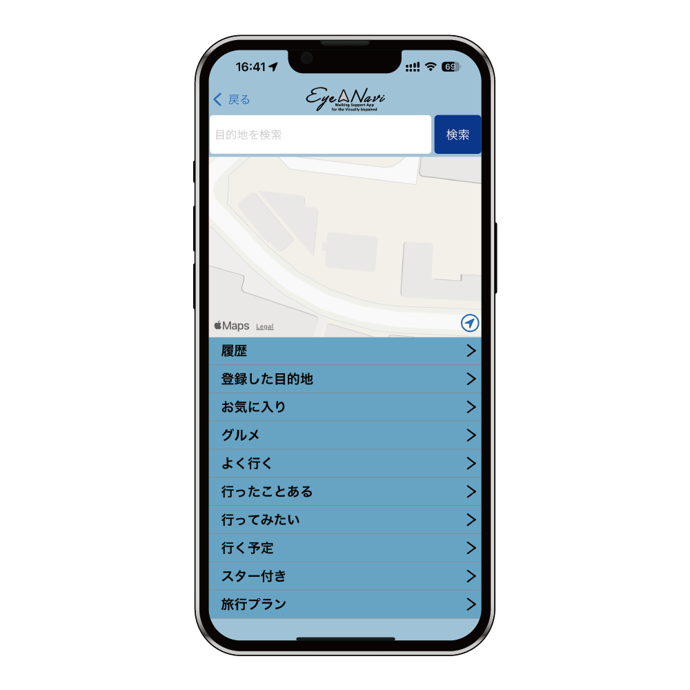
It is a walking support application for the visually impaired and a walking recorder.
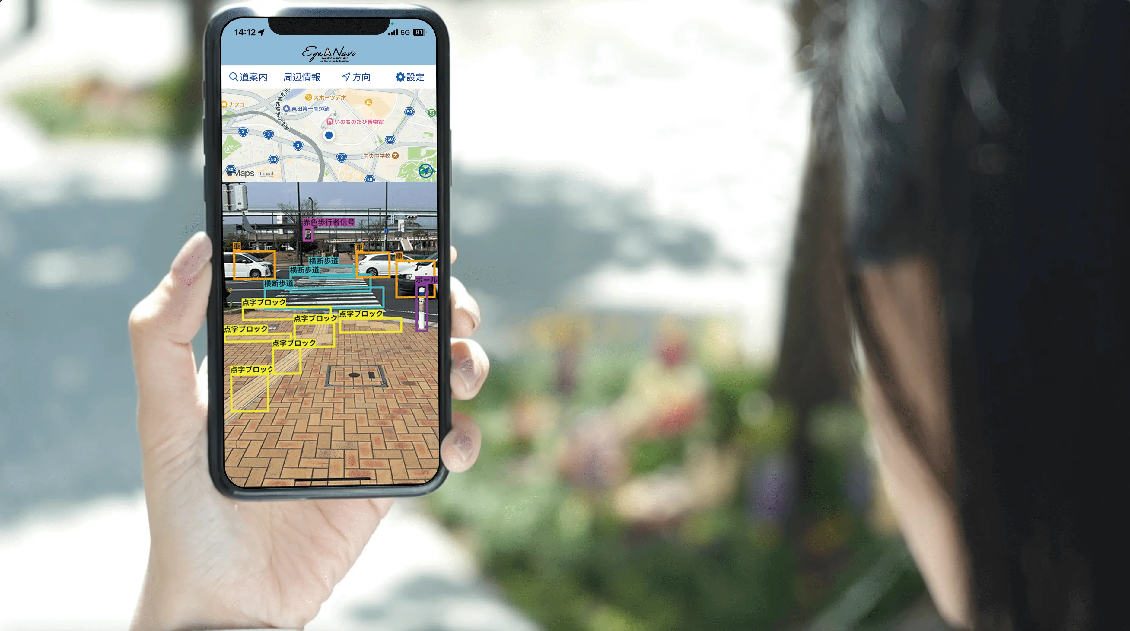
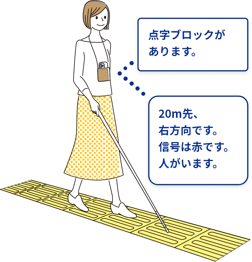
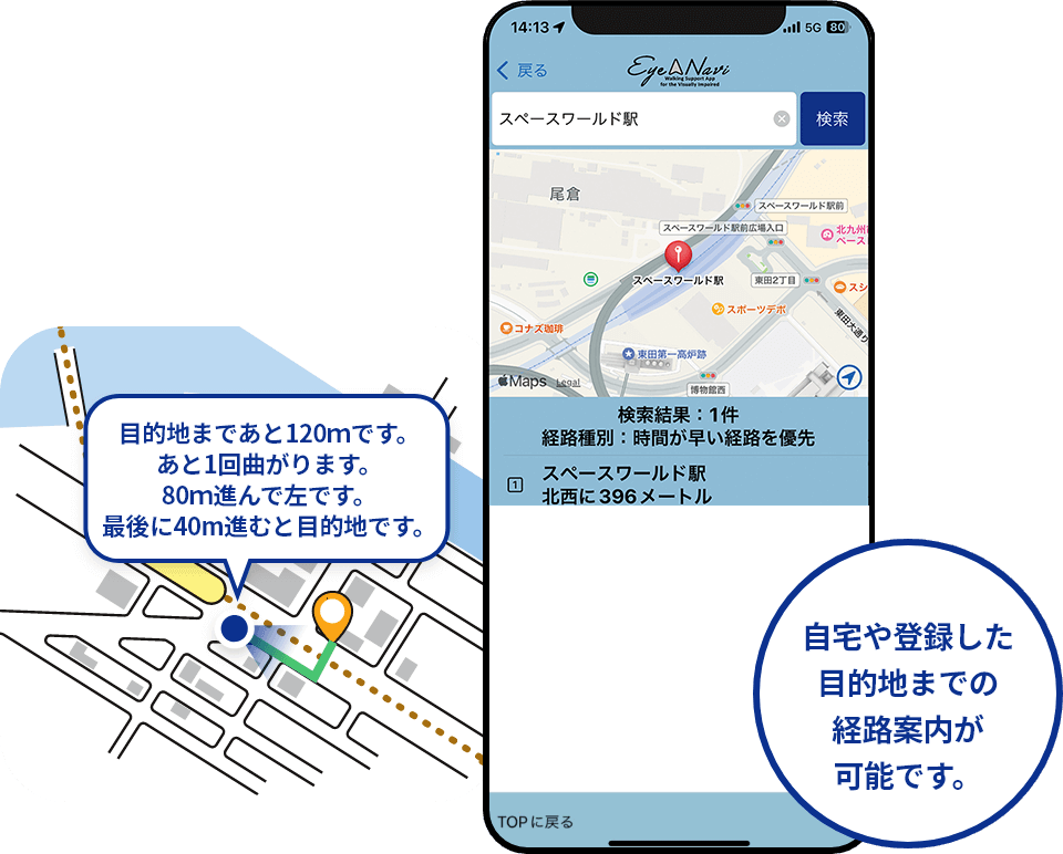
It provides audio information on the direction and route to the destination, nearby facilities, obstacles in the way, the color of pedestrian signals, Braille blocks, etc.
Our goal is to realize a society in which everyone can move freely and happily anywhere.
TECHNOLOGIES
Cutting-edge technology in Eye Navi
01Obstacle and target detection by AI
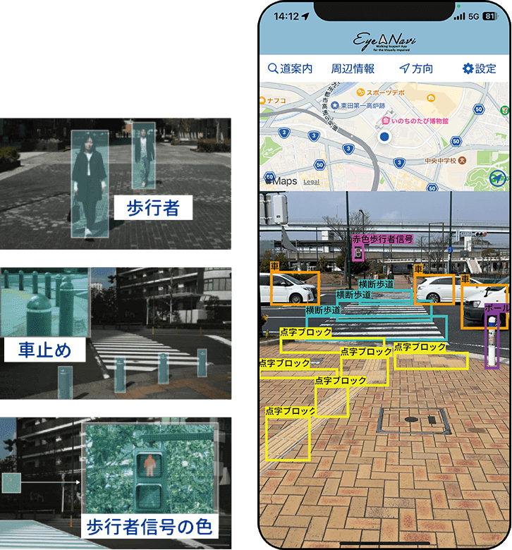
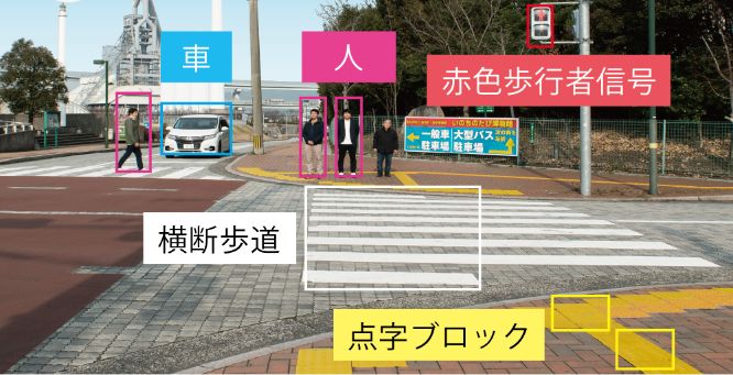
The system provides audible notification of the presence or absence of pedestrians, car stops, and other obstacles to walking, as well as the color of pedestrian signals.
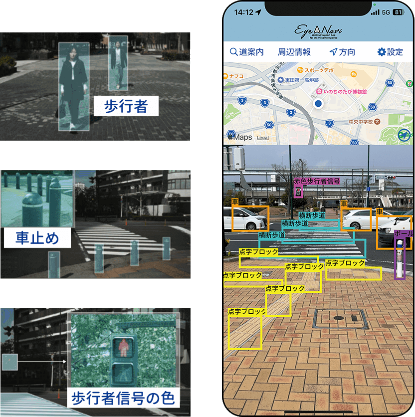
List of recognizable obstacles and targets
(Total 20 types)
People, bicycles, cars, trucks, Braille blocks, white lines, guardrails, crosswalks, “red” and “green” pedestrian signals, curbs, plantings, street trees, vending machines, car stops, poles, fences, post boxes, walls, triangular cones
*Not all obstacles and targets are necessarily detected correctly.
02Route guidance for the visually impaired
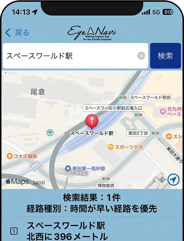
You can check in advance the outline of the route to the destination, the presence or absence of intersections, and information on facilities. You can register your home and destination.
03Walking recorder function
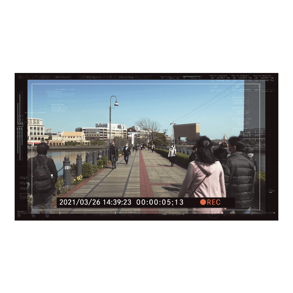
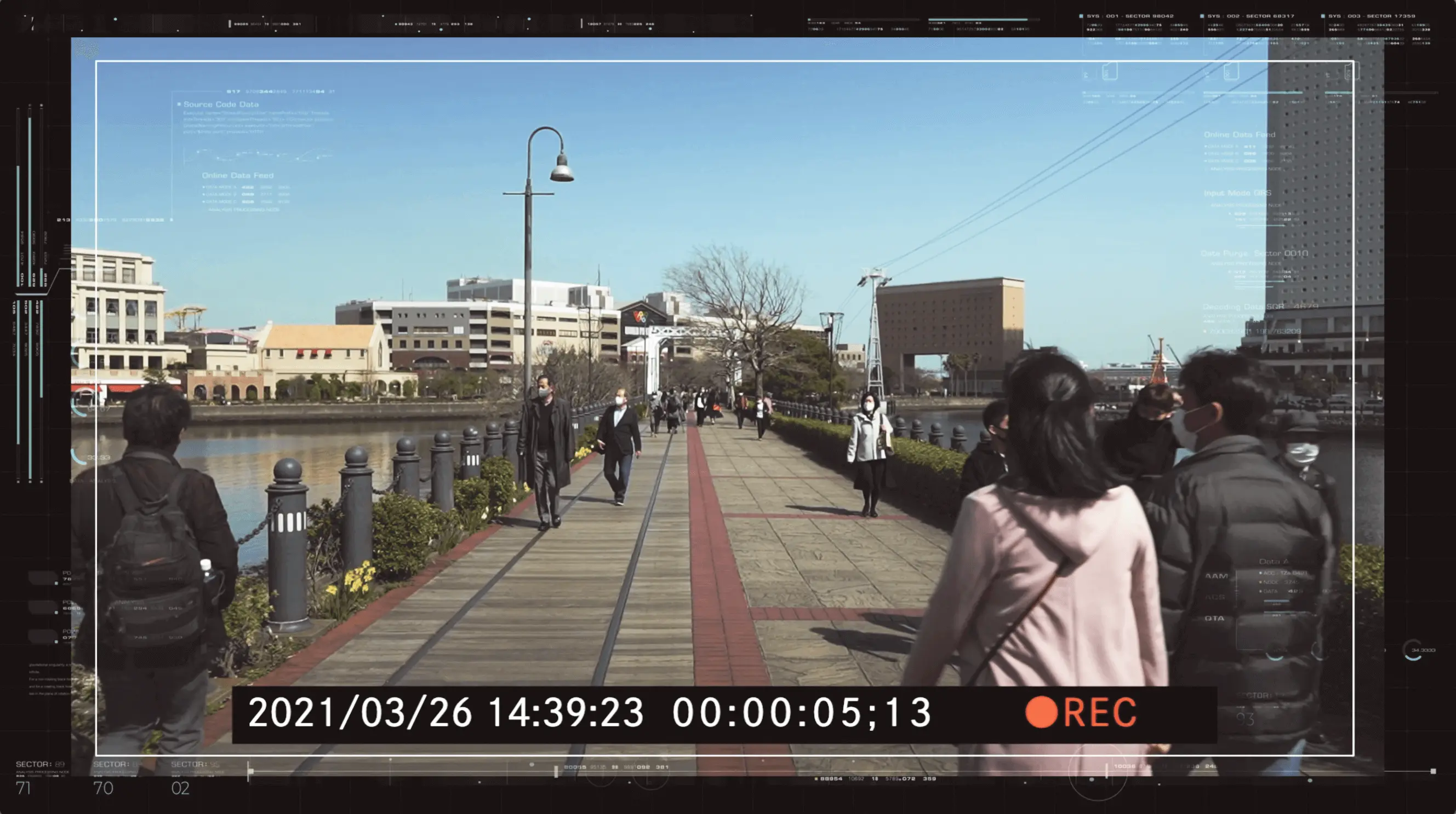
Like a drive recorder in an automobile, it has the ability to automatically store video footage of walking.
List of Functions
| free | premium | |
|---|---|---|
| Monthly Fee | 0 yen | 1,000 yen(including tax) |
| routing guide | Uses Zenrin's pedestrian network data (data for 126 major cities has already been developed)*Use automobile network data for use in areas where pedestrian network data is not yet available. | |
| Object Detection | Capable of detecting 20 types of obstacles and targets in real time using deep learningPeople, bicycles, cars, trucks, Braille blocks, white lines, guardrails, crosswalks, “red” and “green” pedestrian signals, curbs, plantings, street trees, vending machines, car stops, poles, fences, post boxes, walls, triangular cones *Not all obstacles and targets are necessarily detected correctly. |
|
| voice over | 〇 | 〇 |
| Search Nearby Facilities | 〇 | 〇 |
| Body orientation function(orientation) | 〇 | 〇 |
| camera | Using the iPhone rear camera(Camera position varies depending on the model) | |
| sensor(GPS and motion sensor) | 〇 | 〇 |
| Supported devices (iOS 16 and above) | Higher-end models than the iPhone 8 (iPhone8、iPhone8 Plus、iPhoneX、iPhoneXS、iPhoneXS Max、iPhoneXR、iPhone11、iPhone11 Pro、iPhone11 Pro Max、iPhoneSE[Second generation]、iPhone12 mini、iPhone12、iPhone12 Pro、iPhone12 Pro Max、iPhone13 mini、iPhone13、iPhone13 Pro、iPhone13 Pro Max、iPhoneSE[Third generation]、iPhone14、iPhone14 Plus、iPhone14 Pro、iPhone14 Pro Max、iPhone15、iPhone15 Plus、iPhone15 Pro、iPhone15 Pro Max、iPhone16、iPhone16e、iPhone16 Plus、iPhone16 Pro、iPhone16 Pro Max) *The iPhone17 series has not been tested and is not guaranteed to work. | |
| battery | Decreased by about 15% after 30 minutes of use (for iPhone 15 Plus) | |
| application size | Approx. 330 MB.Subject to change due to updates. Use of Wi-Fi is recommended for downloading.Communication charges associated with downloading this application are the responsibility of the user. | |
| Setting value cloud storage | Sign in to store configuration information in the cloud | |
| App traffic | The communication volume is equivalent to that of a typical map application, about 100 MB per month. Note that no communication is used for object detection. Communication charges associated with the use of this application are to be borne by the customer. | |
| Number of registered destinations | Up to 20 entries can be registered | Up to 100 entries can be registered |
| Walking recorder function | Video only (no sound) | Video + Audio |
| Specifications: MOV format.Up to 50 videos (approx. 50 MB) in 5-minute increments (approx. 2.5 GB, approx. 4 hours) will be stored in the device.*To check the video, open the application called “File in iPhone”, and from “In this iPhone”, open the folder “vtr” from “iNavi”. *When the limit is reached, the oldest files will be deleted automatically. | ||
| walking insurance | ― | Personal Accident Insurance (mainly covering property damage in daily life) from Mitsui Sumitomo Insurance.Lifestyle Support Service” is available by phone for consultation on health, medical care, nursing care, legal matters, etc.*Compensation: Compensation for daily life: 10 million yen, damage to personal belongings: 100,000 yen (deductible of 3,000 yen), death or disability due to injury: 100,000 yen*Daily life indemnity covers you in the event that you cause injury to another person or damage to another person's property, for which you are legally liable for compensation. In addition, while a white cane is covered as damage to your personal belongings, glasses, hearing aids, cell phones, computers, tablets, wearable devices and other portable electronic devices and their accessories, animals, etc. are not included in the coverage.
 |
| My route function | ― | Allows you to create your own original routes |
| Watch over function | ― | Real-time sharing of self-location information to family members, companies, and other watchdogs.*Free of charge for those who watch over the system. |
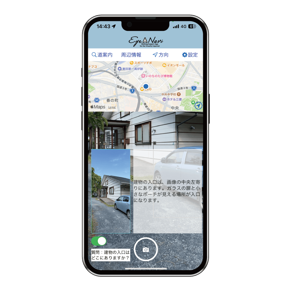
| AI chat function | ― | Explain what you see in the pictures you take. You can also pose any questions you wish.*Usage is limited to 100 times per month. |
Start your Eye Navi Premium Plan trial today!
0 yen for the first 14 days 1,000 yen per month
- Create My Route
- AI Chat
- Walking recorder audio storage
- Walking insurance, etc.
Development Background
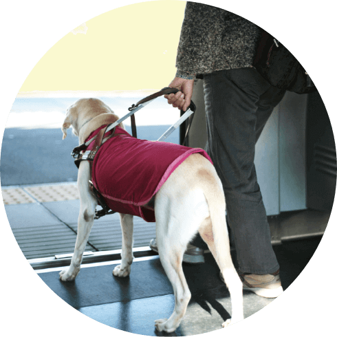
Currently, it is basically not possible to use accompanying assistance by a helper for commuting to work, school, business activities, etc.
Therefore, social activities are restricted if the patient has difficulty getting around on his/her own.
There is also a shortage in the absolute number of accompanying aid employees.
It is not easy for the visually impaired to go out freely on their own, as there are many restrictions.
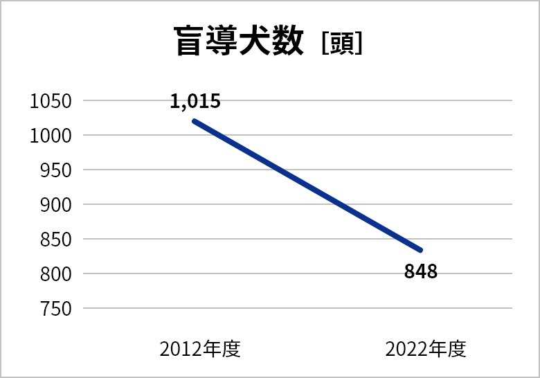
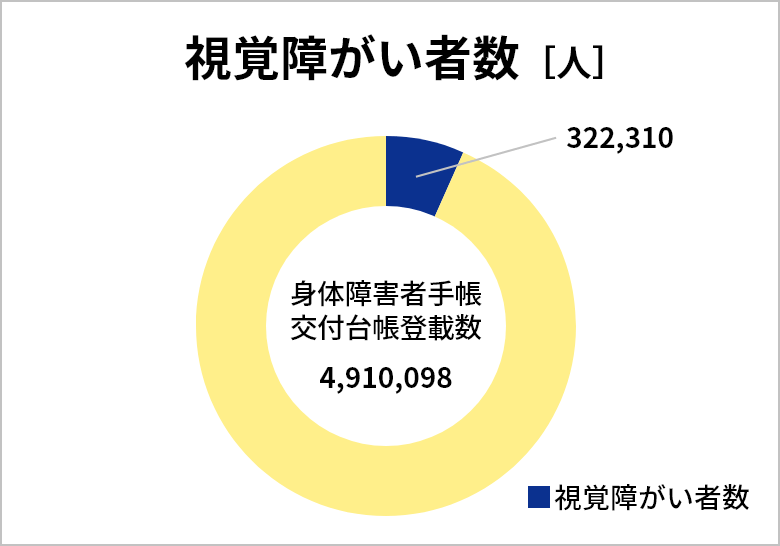
NUMBER OF GUIDE DOGS AND VISUALLY IMPAIRED PERSONS
APP DOWNLOAD
HOW TO USE
Recommended use of Eye Navi
(neck pouch)
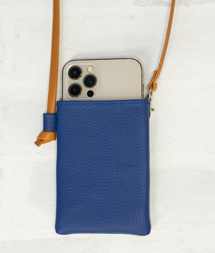
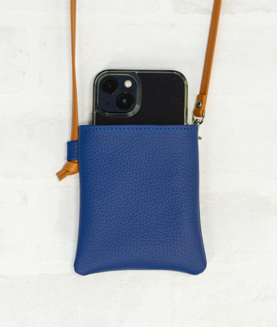
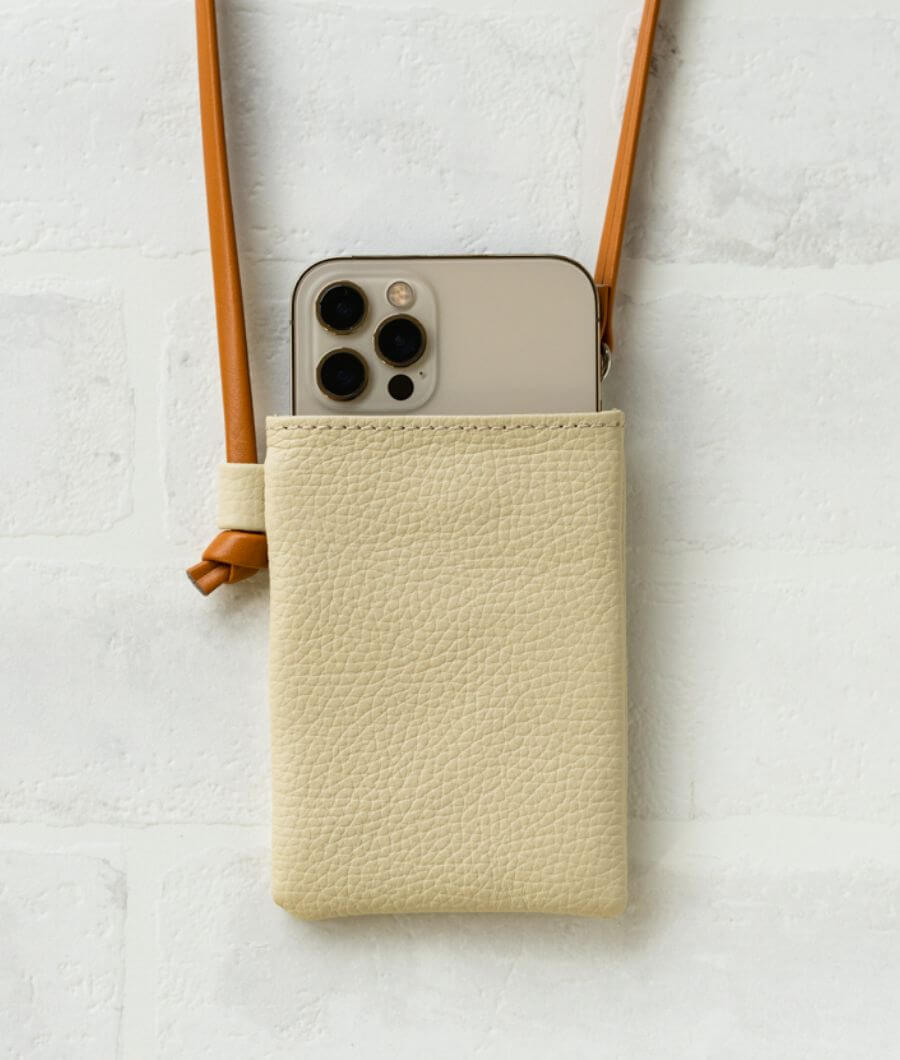
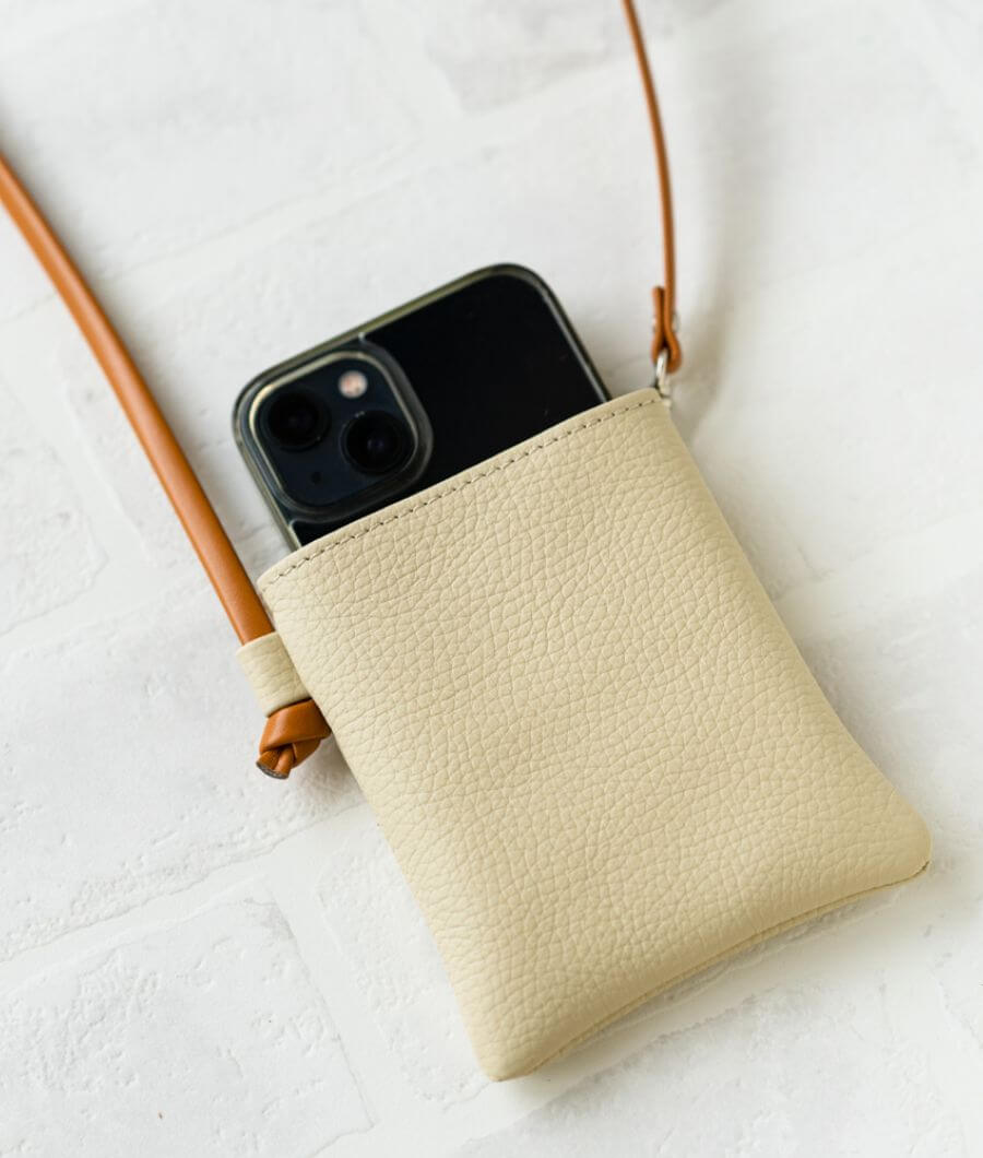
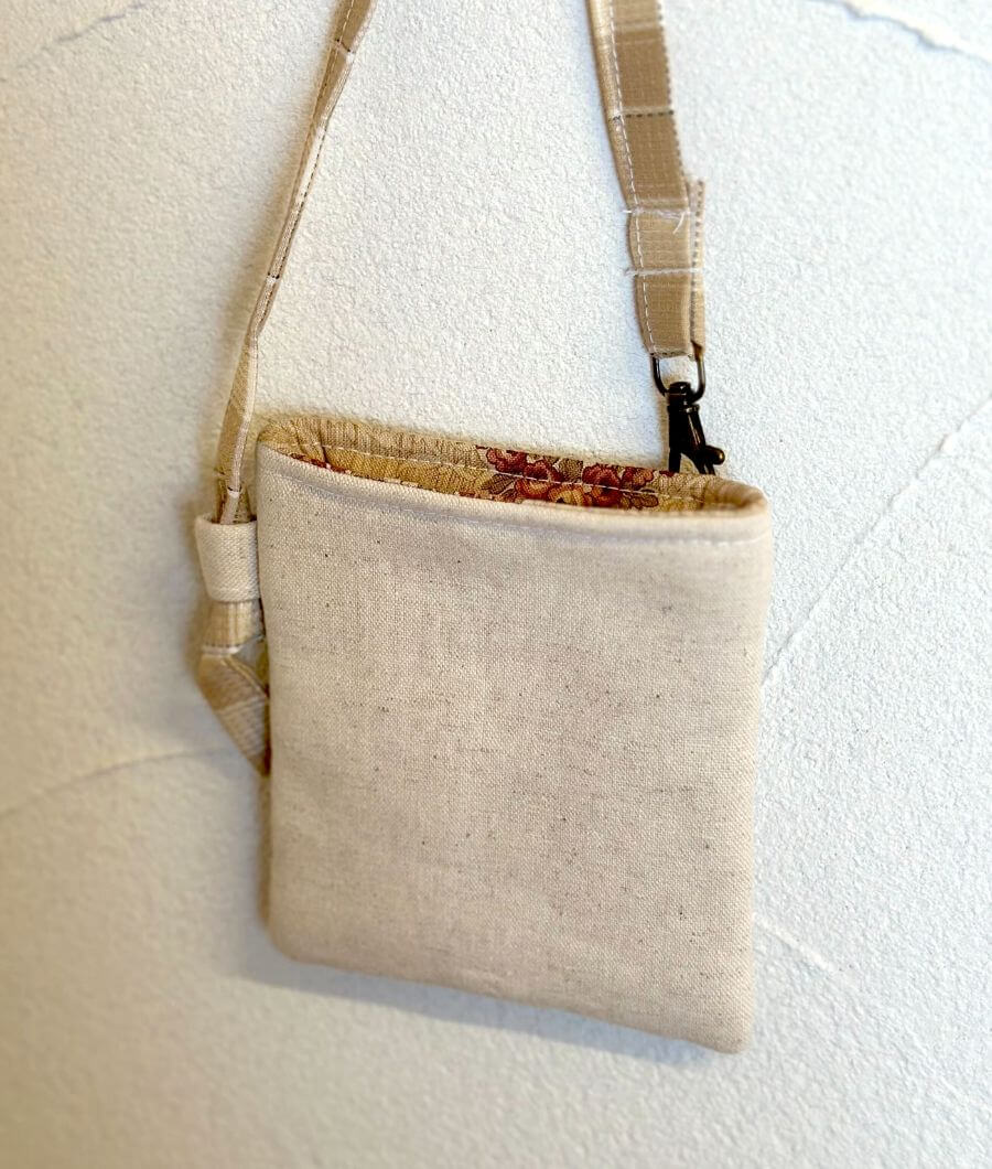
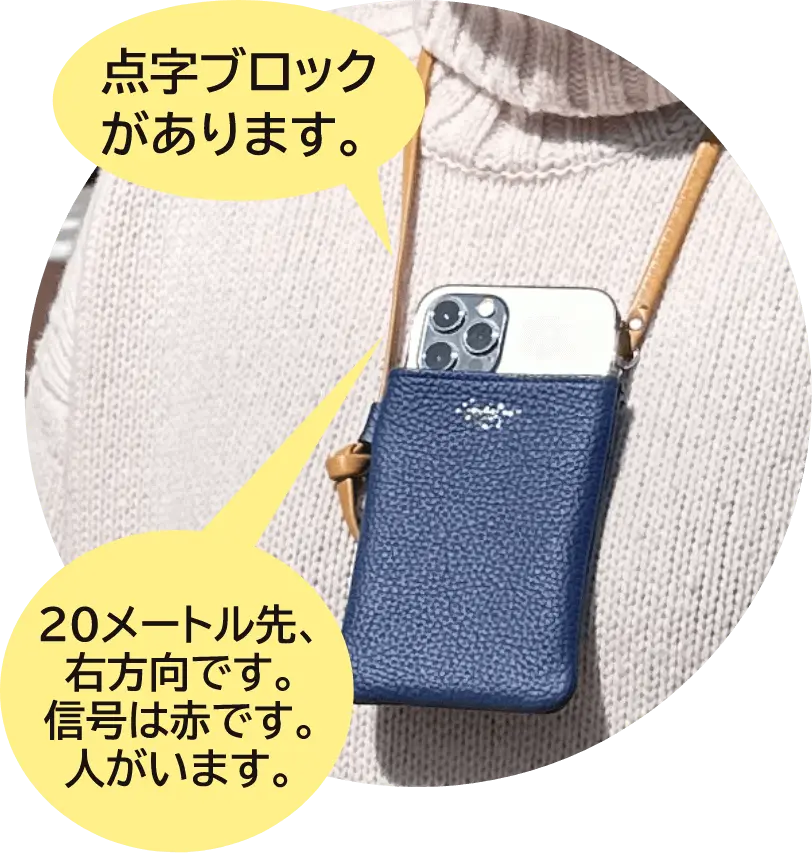
When using Eye Navi, it is recommended that the iPhone be placed in a special pouch so that the camera on the back faces firmly forward. The pouch can be purchased from the Japan Braille Library website.
-
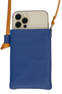
real leather
royal blue -
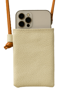
real leather
meringue -
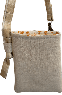
made of cloth
Available in 3 types and 2 sizes
Neck Pouch Sales Handling:Japan Braille Library
Neck Pouch Manufacturer:Custom-made Atelier Philosophii<Philosophii>
【important】Terms of Use
Estimated users/Any degree of visual impairment is acceptable, but the applicant must be able to walk independently and operate an iPhone.
Even if a person is unable to walk alone, it can be used as a reference for walking when walking with a companion.
- ●This service is available throughout Japan.
- ●It is recommended to use the system outdoors where there are Braille blocks.
- ●It is not recommended for use indoors, such as inside homes, facilities, and train stations. It also cannot be used in underground malls.
- ●Basically, we recommend using the system during the daytime. The route guidance function can be used at night.
- ※Information provided by Eye Navi is not always accurate.Please agree to the full text of the Terms of Use displayed when launching the application, and use the application at your own risk.The Company shall not be liable for any damages incurred by users.
Acquisition of patents, etc.
Patented “Sidewalk Progression Support System and Sidewalk Progression Support Software
Patented “Pedestrian Location Identification System and Pedestrian Location Identification Software
Patented “Pedestrian Direction Determination System and Pedestrian Direction Determination Software
Method for determining pedestrian signal signals and pedestrian signal determination system” pending
Eye Navi” trademark registered
Frequently Asked QuestionsQ & A
Frequently Asked Questions
- What kind of application is it?
- This iPhone app provides information necessary for visually impaired people to travel on foot. It has an image recognition function that uses AI (artificial intelligence) to detect obstacles on the path, the color of pedestrian signals, and landmarks such as braille blocks, as well as a route guidance function that is considerate to visually impaired people, and a walking recorder function that records video of the user as they walk.
- What do I need to use the service?
- It can only be used with smartphones (iPhone). First, download the Eye Navi app from the App Store. When using the app, we recommend placing your iPhone in a special neck pouch or similar, with the rear camera facing forward.
- Who are the intended users?
- The target audience is anyone with any level of visual impairment who can walk independently and operate an iPhone. Even if you cannot walk independently, you can use the app to help you when walking with a family member or accompanying support person.
- How much is the usage fee?
- There are two plans available: a free plan that offers basic functions free of charge, and a premium plan that includes multiple added-value functions. The premium plan costs 1,000 yen (tax included) per month. The basic functions are object detection, route guidance, nearby facility search, body orientation (direction confirmation), and walking recorder (saves video only). In addition to these basic functions, the premium plan also includes a personalized route creation function, AI chat (scene description), monitoring function, walking recorder (video + audio), and walking insurance.
- Why is it available for free?
- We are able to provide the basic functions free of charge thanks to the sponsorship of companies that support the solution of social issues through this initiative. We are always looking for companies and organizations to support us.
- How can I use it?
- Please download the app from the download button on this site. You can also download it by searching for "Inavi" in the iPhone App Store.
How to use
- When is it available?
- This can be used when you need route guidance to a destination outdoors, when you want to check your surroundings while walking, etc. The AI chat function in the Premium Plan can be used for a wide range of purposes, including checking the surroundings, describing scenes, and reading text aloud, both indoors and outdoors.
- What can I do in the directions mode?
- In addition to detecting targets and obstacles, the road guidance mode provides route guidance to the destination and information on nearby facilities such as convenience stores.
- Is it available indoors?
- We do not recommend using the device indoors, such as at home, in facilities, train stations, or underground malls.
- Is it available in places I've never been before?
- You can use this app even in places you've never been before, but please use it only in places with tactile paving and make sure that your surroundings are safe. We aim to help you feel safe when going to new places by using this app.
- Can it be used in the dark at night?
- Basically, we recommend using the system during the daytime. The route guidance function can be used at night.
- Can you provide insurance for accidents that occur during use?
- When you start using the app, the terms of use will be displayed. You can use the app only after agreeing to these terms. Please note that the information provided by this app is not always accurate. Use the app at your own risk. We are not liable for any damages incurred by the user.
- Depending on the case of your iPhone, you may not be able to obtain the azimuth due to the influence of magnetism. Please remove the case and check again.
- Eye Navi cannot obtain direction.
- Depending on the iPhone case, magnetic fields may affect the direction and prevent it from being obtained. Please remove the case and check again.
- Can I use it overseas?
- Currently available only in Japan.
Apps & Functions
- What iPhone models are compatible?
- Compatible with iPhone 8 and later models. (iPhone 8, iPhone 8 Plus, iPhone X, iPhone XS, iPhone XS Max, iPhone XR, iPhone 11, iPhone 11 Pro, iPhone 11 Pro Max, iPhone SE (2nd generation), iPhone 12 mini, iPhone 12, iPhone 12 Pro, iPhone 12 Pro Max, iPhone 13 mini, iPhone 13, iPhone 13 Pro, iPhone 13 Pro Max, iPhone SE (3rd generation), iPhone 14, iPhone 14 Plus, iPhone 14 Pro, iPhone 14 Pro Max, iPhone 15, iPhone 15 Plus, iPhone 15 Pro, iPhone 15 Pro Max, iPhone 16, iPhone 16e, iPhone 16 Plus, iPhone 16 Pro, iPhone 16 Pro Max) *Operation is not guaranteed with the iPhone 17 series, as it has not been tested.
- Are there any plans to support Android?
- None so far.
- What is the size of the application?
- Approximately 300 MB. This may change due to updates. Wi-Fi is recommended during installation.
※Communication charges associated with downloading this application are the responsibility of the user. - How much traffic does the application receive?
- The amount of communication is equivalent to that of a typical map application.
※ Communication charges associated with the use of this application are to be borne by the customer. - What is the battery consumption?
- This is approximately 10% for one hour of use (in the case of iPhone 12).
- Is voice over supported?
- Supported. Since the application itself has a speech function, it may be covered by the voice over.
- Which camera do you use?
- I use the rear camera on my iPhone: the bottom camera on the 14 Pro and 13 Pro, and the top camera on the 12 Pro and 11 Pro.
- Can I use the application with my iPhone in landscape mode?
- The app cannot be used with the iPhone held in landscape orientation. Please use the app in portrait orientation with the camera facing up. It also cannot be used upside down.
- Please tell me about the "Range for obstacle guidance" setting.
- "Front only" will notify you of objects you may collide with while walking. "Front + left and right" will also provide reference information on objects on the left and right that are less likely to be collided with. The default setting is "Front only." If you want to obtain information over a wider area to assess the surrounding situation, change it to "Front + left and right." Please note that the color of the pedestrian signal will be detected and notified in the same way in either case.
safety
- Wouldn't you be mistaken for a walking smartphone?
- Do not operate the app while walking, but always stop in a safe place before operating it. We recommend that you use the app while your iPhone is in the dedicated neck pouch.
- Is image recognition and route guidance 100% correct?
- This app may give incorrect guidance depending on the environment you are using it in. When a message appears from the app, be sure to check the content of the message yourself by checking with your white cane or listening carefully to the sounds around you, and then decide whether or not to follow the message before using it.
- Will the app allow me to walk outside without a white cane? Will it allow me to walk outside without gait training?
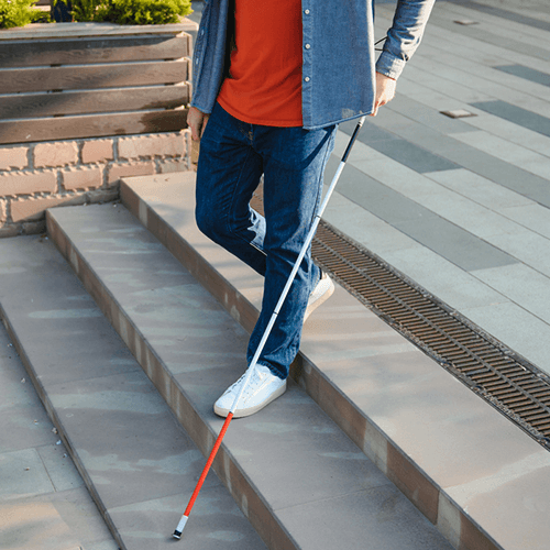
- This app is intended to assist you in walking by providing information about your surroundings, but does not guarantee your safety. When using this app, please pay close attention to your surroundings and always walk with a white cane or guide dog.
- Isn't it dangerous to walk with a white cane and a smartphone?
- When using the device, you can place your iPhone in the dedicated neck pouch and walk without holding it in your hand.
- How does weather affect signal detection?
- Detection accuracy may be affected under backlight conditions, such as in the evening when the western sun is strong.
- Please tell me about using the service in places where GPS is difficult to reach, such as underground malls.
- In places such as underground malls, large facilities, arcades, under elevated tracks, and places surrounded by tall buildings, GPS information can be unstable, making accurate guidance difficult. This is a common issue with general GPS navigation. For this reason, we currently assume that the main use scenario will be outdoor ground travel.
- Please tell me what to keep in mind when using the service.
- The app is merely a tool to assist with walking, and has limitations such as being "dependent on GPS accuracy" and "affected by environmental conditions (light, obstructions)." Therefore, we believe that it is best to prioritize the user's walking ability and avoid excessive reliance on the app.
- As the app becomes more widespread, please tell us about the support facilities and other organizations that are introducing it and providing instruction on how to use it.
- We believe it is important for facilities and schools to provide opportunities for introductions and experiences, assess suitability for use, and position the device as an auxiliary tool rather than a replacement for independent walking. If you have any specific questions, please contact us.
Premium Plan
- Does the Premium Plan's walking insurance only cover me while using Eye Navi?
- Even if you do not use the app, you can still file an insurance claim within the scope of the coverage.
- How do I cancel my Premium Plan trial and subscription?
- To cancel, please follow the steps below. When using voice over, please double-tap instead of tapping.
- Launch the Settings application on your iPhone.
- Tap the second “Apple Account” button from the top.
- Tap the fourth “Subscription” button from the top.
- Tap the “Eye Navi Premium” button.
- Tap the “Cancel Free Trial” button or “Cancel Subscription.
- Tap the “Confirm” button. If you do not wish to cancel, tap the “Not now” button below it.
- If I temporarily cancel my Premium Plan, will my route information be available after I re-register?
- My Routes information will remain on the server even after Premium Plan cancellation, and can be used after Premium Plan re-registration.

A word from an Eye Navi advisor
Mayumi Seo, a visually impaired person, is one of the collaborators who has continued to provide advice on the application since its development.
We have high expectations for this “extra help” when going out.
Seo said, “I hope it reaches many people. I hope it will be a source of comfort for those who are afraid to go outside and are in despair.” She also hopes that the book will be a source of comfort for those who are afraid to go outside and are in despair.
Commitment to the SDGs
Aiming to achieve this goal worldwide by 2030 under the slogan “No one will be left behind.
Our commitment to the Sustainable Development Goals (SDGs)
SDGs x Visually Impaired
03.Health and well-being for all
Ensure healthy living and promote the well-being of all people of all ages
We believe that Eye Navi can contribute to the Japanese government's goal of “3.6 Halve the number of people killed or injured in road traffic accidents worldwide by 2020. We believe that Eye Navi can contribute to this goal by providing information (color of people, cars, Braille blocks, and pedestrian signals, recognition of obstacles such as pedestrian crossings, and route guidance to destinations).
By utilizing Eye Navi, for example, the color of traffic signals can be recognized at crosswalks without sound signals, thereby increasing safety. It also eliminates the problem of no sound at night, even if they are installed.

10.Let's eliminate inequality among people and countries.
Reduce inequalities within and among countries
The Japanese government's stated goal “10.2 By 2030, promote the empowerment and social, economic, and political inclusion of all people regardless of age, gender, disability, race, ethnicity, origin, religion, economic status, or other circumstances. We believe that Eye Navi can contribute to this goal through the provision of information (color of people, cars, Braille blocks, and pedestrian signals, recognition of obstacles such as crosswalks, and route guidance to destinations).
In the development process of Eye Navi, we are taking the approach of “inclusive design” to improve the quality of service together with visually impaired people. Eye Navi may enable, for example, visually impaired people who could not go out without assistance to do so.

11.Creating a town where people can continue to live.
Achieve inclusive, safe, resilient, and sustainable cities and human settlements
The Japanese government's goal “11.7 By 2030, provide universal access to safe, inclusive, and accessible green spaces and public spaces for people, including women, children, the elderly, and people with disabilities. We believe that Eye Navi can contribute to this goal by providing information (color of people, cars, Braille blocks, and pedestrian signals, recognition of obstacles such as pedestrian crossings, and route guidance to destinations).
Eye Navi, for example, can be used to provide information and directions to the visually impaired in areas where Braille blocks have not been installed. Such measures for the disabled are not only beneficial to the disabled, but have the potential to become universal services that benefit many more people.

17.Achieve your goals in partnership!
Strengthen the means of implementation for sustainable development and revitalize the global partnership
The Japanese government's stated goal of “17.17 Encourage and promote effective public, public-private, and civil society partnerships based on a variety of partnership experiences and resource strategies. We believe that Eye Navi's efforts will contribute to this goal.
Eye Navi has been able to continue its research and development to this point thanks to support from the Ministry of Health, Labor and Welfare and other organizations. The project is made possible through collaboration with civic groups such as support groups for the visually impaired, academic institutions such as Tokyo Metropolitan University, and various partnerships with private companies.
Major Achievements to Date
-
2017Selected for Fukuoka Prefecture's project to support the development of robots and system-related products for the medical, welfare, and social system fields.
-
2018Selected for the Kitakyushu Foundation for the Advancement of Industry and Science (FAIS) Practical Application R&D Project
-
2018〜2020Adopted by the Ministry of Health, Labour and Welfare for the project to promote the development of equipment to support the independence of persons with disabilities, etc.
-
2022Won the Prime Minister's Prize in the Idea Category for “Mebuku Eye” in collaboration with Maebashi City, Gunma Prefecture, in the Digita Koshien of the Cabinet Office's Digital Rural City National Initiative.
-
2022In response to a request from Ise City, Mie Prefecture, for a “Barrier-Free Tourism Support Study to Accommodate Diverse Actors,” a demonstration experiment will be conducted in 2022 on the approach to the outer shrine of Ise Jingu. Preparations are underway to make it possible to download sightseeing packages in the application in the future.
-
2022Adopted for the VISI-ONE Accelerator Program by Santen Pharmaceutical and others
-
2022Toyota Mobility Fund's “Make a Move Project” adopted
-
2022〜Selected as a project to be subsidized by the National Institute of Information and Communications Technology (NICT) for the “Subsidy for Promotion of Information Barrier-Free Communication and Broadcasting Service Provision and Development”.
SPONSOR
Purpose of sponsorship
- Basic functions are provided free of charge in order to realize a society in which everyone can move freely and happily anywhere.
- The free of charge program will be made possible through sponsorship from companies that support the resolution of social issues through this initiative.
We are calling for companies and organizations that are willing to support us, and we are always looking for more.
- ※iPhone” is a trademark of Apple Inc.
- ※QR Code” is a trademark of DENSO WAVE INCORPORATED.
